| Locator | Hist Soc - HS-G00783 | Type | Drawing | Doc Number | V-18-O/28 | |
|---|---|---|---|---|---|---|
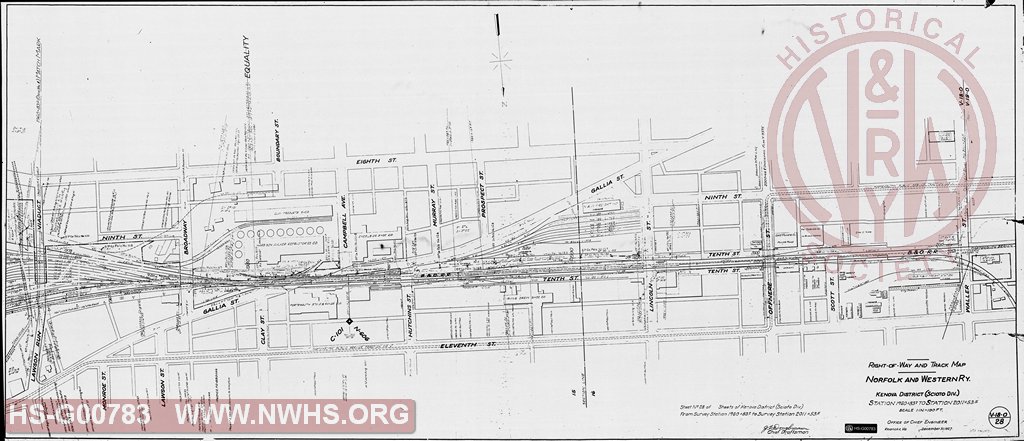
| Description | Right of Way and Track Map - Kenova District (Scioto Division), Station 1960+83.2 to 2011+53.5 (MP 606) | |||||
| Notes | Scale 1"=100'. Covers Portsmouth, OH between Lawson Run Viaduct and Waller St. Shows old and freight stations, St. Clair hotel, tracks serving Harbison Walker Refractories Co., east end of yard, and the tracks of the B&OW SW and the Portsmouth Public Service Traction Co. |
|||||
| Date | 12/31/1927 | Revision Date | ||||
| Author | N&W Rwy - Office Chief Engr | Accession | ||||

|
||
Size: 56in x 24in (142cm x 61cm) |
| Cities Indexes | |
|---|---|
| City | State |
| Portsmouth | OH |
| Structures Indexes | |
|---|---|
| Category | Type |
| Station | Freight |
| Yard | |
| Right of Way | |
| Railroads and Companies | |
|---|---|
| Abbreviation | Name |
| N&W Rwy | Norfolk & Western Railway |
| B&O SWRR | Baltimore & Ohio Southwestern Railroad |
| Harbison Walker Refractories Co. | |
| Portsmouth Public Service Traction Co. | |
| Division Indexes | |||
|---|---|---|---|
| Road Name | Division | District/Branch | Mile Post |
| N&W Rwy | Scioto | 606 | |
| Related Documents | |||
|---|---|---|---|
| Type | Number | Locator | Description |
| Related | V-19-O/1 | Hist Soc - HS-G00781 | Station Map - Track and Structures Scioto District, Station 0+00 to 54+89.7 (MP 607) |
| Related | V-18-O/27 | Hist Soc - HS-G00782 | Right of Way and Map - Kenova District (Scioto Division), Station 1908+03.2 to 1960+83.2 (MP 605) |