| Locator | Hist Soc - HS-G00782 | Type | Drawing | Doc Number | V-18-O/27 | |
|---|---|---|---|---|---|---|
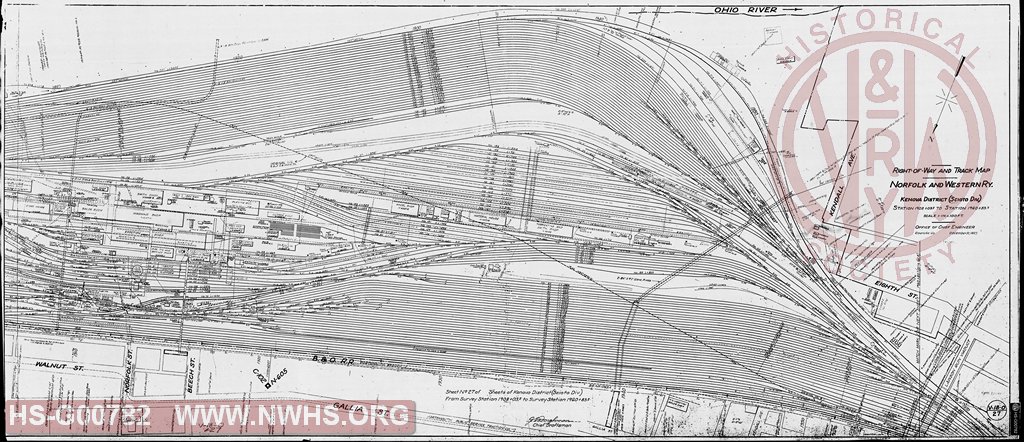
| Description | Right of Way and Map - Kenova District (Scioto Division), Station 1908+03.2 to 1960+83.2 (MP 605) | |||||
| Notes | Scale 1"=100'. Covers Portsmouth, OH between Norfolk St. and Lawson Run Viaduct. Shows YMCA, middle of yard, shops area, and the tracks of the B&W SW and the Portsmouth Public Service Traction Co. |
|||||
| Date | 12/31/1927 | Revision Date | ||||
| Author | N&W Rwy - Office Chief Engr | Accession | ||||

|
||
Size: 56in x 24in (142cm x 61cm) |
| Cities Indexes | |
|---|---|
| City | State |
| Portsmouth | OH |
| Structures Indexes | |
|---|---|
| Category | Type |
| Shops | |
| Yard | |
| Building | YMCA |
| Right of Way | |
| Railroads and Companies | |
|---|---|
| Abbreviation | Name |
| N&W Rwy | Norfolk & Western Railway |
| B&O SWRR | Baltimore & Ohio Southwestern Railroad |
| Portsmouth Public Service Traction Co. | |
| Division Indexes | |||
|---|---|---|---|
| Road Name | Division | District/Branch | Mile Post |
| N&W Rwy | Scioto | 605 | |
| Related Documents | |||
|---|---|---|---|
| Type | Number | Locator | Description |
| Related | V-18-O/28 | Hist Soc - HS-G00783 | Right of Way and Track Map - Kenova District (Scioto Division), Station 1960+83.2 to 2011+53.5 (MP 606) |