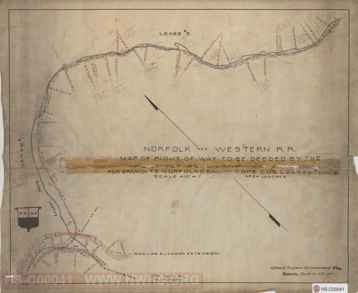
| Locator | Hist Soc - HS-C00041 | Type | Map | Doc Number | PH 129 | |
|---|---|---|---|---|---|---|
| Description | Map of Right of Way to be Deeded by the Flat Top Coal Land Co for Branch to Norfolk Coal and Coke Co's Leases #1 and #3 | |||||
| Notes | Scale 400'=1" | |||||
| Date | 06/21/1892 | Revision Date | ||||
| Author | N&W RR - Engr Maint of Way | Accession | 2005.004 : Library of Virginia | |||

|
||
Size: 18in x 15in (45cm x 37cm) |
| Cities Indexes | |
|---|---|
| City | State |
| Lick Branch | WV |
| Maybeury | WV |
| Switchback | WV |
| Structures Indexes | |
|---|---|
| Category | Type |
| Right of Way | |
| Company Document Indexes | ||
|---|---|---|
| Name | Section | SubSection |
| N&W RR | Right of Way Maps | |
| Railroads and Companies | |
|---|---|
| Abbreviation | Name |
| N&W RR | Norfolk & Western Railroad |
| Flat Top Coal Land Co | |
| Norfolk Coal and Coke Co. | |
| Division Indexes | |||
|---|---|---|---|
| Road Name | Division | District/Branch | Mile Post |
| N&W RR | Pocahontas | ||