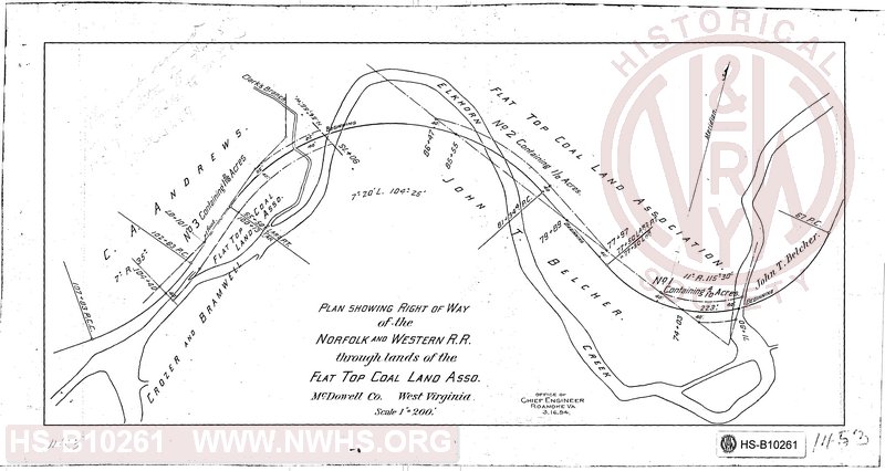
| Locator | Hist Soc - HS-B10261 | Type | Drawing | Doc Number | 1453 | |
|---|---|---|---|---|---|---|
| Description | Plan showing Right of Way of the N&W RR through the land of Flat Top Coal Land Asso, McDowell Co, W. Va | |||||
| Notes | Scale 1"=200' | |||||
| Date | 03/16/1894 | Revision Date | ||||
| Author | N&W RR - Office of Chief Engr | Accession | 2009.001 : NS Corp/Va Tech Collection | |||

|
||
Size: 17in x 9in (44cm x 24cm) |
| Cities Indexes | |
|---|---|
| City | State |
| McDowell County | WV |
| Structures Indexes | |
|---|---|
| Category | Type |
| Right of Way | |
| Company Document Indexes | ||
|---|---|---|
| Name | Section | SubSection |
| N&W RR | Right of Way Maps | |
| Railroads and Companies | |
|---|---|
| Abbreviation | Name |
| N&W RR | Norfolk & Western Railroad |
| Division Indexes | |||
|---|---|---|---|
| Road Name | Division | District/Branch | Mile Post |
| N&W RR | Pocahontas | ||
| N&W RR | Ohio Extension | ||