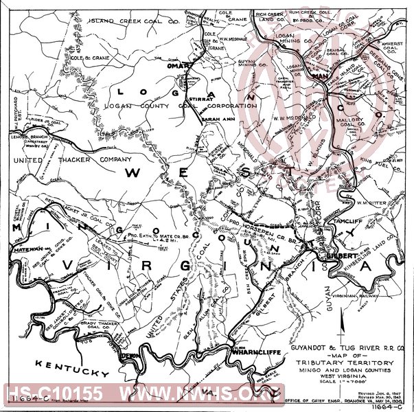
| Locator | Hist Soc - HS-C10155 | Type | Map | Doc Number | 11664-C | |
|---|---|---|---|---|---|---|
| Description | Guyandot & Tug River R.R. Co., Map of Tributary Territory, Mingo and Logan Counties WV | |||||
| Notes | Scale: 1"=7000', "From Richards Map", In pencil hows "Pro. Extn. to mate Cr. Br L=4.2 mi" | |||||
| Date | 05/24/1930 | Revision Date | 01/06/1947 | |||
| Author | N&W Rwy - Office Chief Engr | Accession | 2009.001 : NS Corp/Va Tech Collection | |||

|
||
Size: 15in x 15in (39cm x 38cm) |
| Cities Indexes | |
|---|---|
| City | State |
| Elmore | WV |
| Gilbert | WV |
| Wharncliffe | WV |
| Man | WV |
| Omar | WV |
| Company Document Indexes | ||
|---|---|---|
| Name | Section | SubSection |
| N&W Rwy | Maps | |
| Railroads and Companies | |
|---|---|
| Abbreviation | Name |
| Guyandot & Tug River | Guyandot and Tug River Railroad Co. |
| Division Indexes | |||
|---|---|---|---|
| Road Name | Division | District/Branch | Mile Post |
| N&W Rwy | Pocahontas | ||
| Related Documents | |||
|---|---|---|---|
| Type | Number | Locator | Description |
| Related | 11664-A | Hist Soc - HS-B24716 | Guyandot & Tug River, Map showing Proposed Horsepen Creek Branch, Mingo County, WV. |
| Related | 11664-B | Hist Soc - HS-B24717 | Guyandot & Tug River, Map showing Coal Properties in vicinity of Gilbert, Mingo County, WV. |
| Related | 11664-D | Hist Soc - HS-C05228 | N&W Ry, Situation of Possible Coal Development in Mingo and Logan Counties, McDonald Land Co. Property |