| Locator | Hist Soc - HS-B05078 | Type | Drawing | Doc Number | Y-7717 | |
|---|---|---|---|---|---|---|
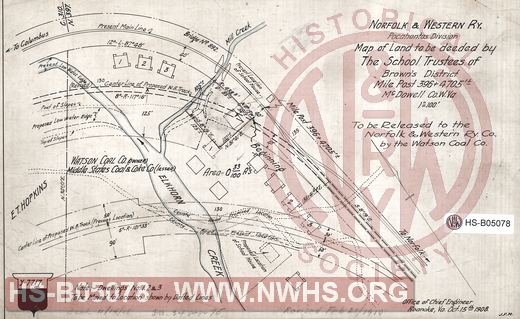
| Description | N&W Ry, Pocahontas division, Map of land to be deeded by The School Trustees of Brown's Disctrict, MP 396+4705', McDowell Co. W.Va. | |||||
| Notes | Scale 1"=100', Shows bridge 892 | |||||
| Date | 10/15/1908 | Revision Date | 02/21/1910 | |||
| Author | N&W Rwy - Office Chief Engr | Accession | 2005.004 : Library of Virginia | |||

|
||
Size: 13in x 8in (33cm x 20cm) |
| Structures Indexes | |
|---|---|
| Category | Type |
| Land | |
| Railroads and Companies | |
|---|---|
| Abbreviation | Name |
| N&W Rwy | Norfolk & Western Railway |
| Division Indexes | |||
|---|---|---|---|
| Road Name | Division | District/Branch | Mile Post |
| N&W Rwy | Pocahontas | 397 | |