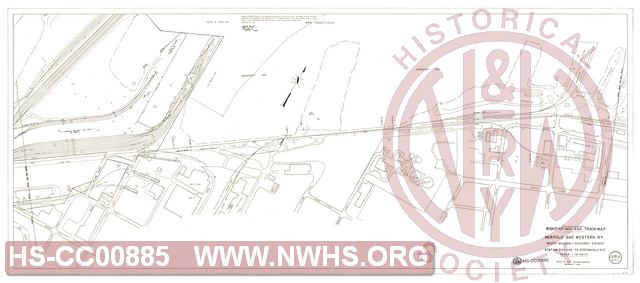
| Locator | Hist Soc - HS-CC00885 | Type | Drawing | Doc Number | V-18-O/277 | |
|---|---|---|---|---|---|---|
| Description | Right of Way and Track Map, N&W Rwy Scioto Div. Sandusky District, Station 5799+40 to Station 5852+20 | |||||
| Notes | Covers portion of yards at lake pier. Reduced size photocopy. Original scale 1"=100'. |
|||||
| Date | 12/01/1970 | Revision Date | ||||
| Author | N&W Rwy - Office Chief Engr | Accession | 2018.003 : John S. Garner | |||

|
||
Size: 29in x 13in (73cm x 32cm) |
| Cities Indexes | |
|---|---|
| City | State |
| Sandusky | OH |
| Structures Indexes | |
|---|---|
| Category | Type |
| Pier | Coal |
| Yard | |
| Pier | |
| Railroads and Companies | |
|---|---|
| Abbreviation | Name |
| N&W Rwy | Norfolk & Western Railway |
| Division Indexes | |||
|---|---|---|---|
| Road Name | Division | District/Branch | Mile Post |
| N&W Rwy | Scioto | Sandusky District | 109.5 |
| Related Documents | |||
|---|---|---|---|
| Type | Number | Locator | Description |
| Related | V-18-O/276A | Hist Soc - HS-CC00886 | Right of Way and Track Map, N&W Rwy Scioto Div. Sandusky District, Station 8+40 to Station 60+00 |
| Related | V-18-O/276 | Hist Soc - HS-CC00884 | Right of Way and Track Map, N&W Rwy Scioto Div. Sandusky District, Station 5746+60 to Station 5799+40 |