| Locator | Hist Soc - HS-B10793 | Type | Drawing | |||
|---|---|---|---|---|---|---|
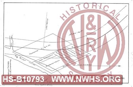
| Description | Untitled map showing Right of Way through land of Pocahontas Coal & Coke Co. on west side of Tug River north of Mill Creek | |||||
| Notes | Presumed to be Wilcoe, WV. Was originally numbered 6324, crossed out with note "is incorrect. Correct number cannot be determined from Index Book". |
|||||
| Date | Revision Date | |||||
| Author | Pocahontas Coal & Coke Co | Accession | 2009.001 : NS Corp/Va Tech Collection | |||

|
||
Size: 13in x 9in (34cm x 22cm) |
| Cities Indexes | |
|---|---|
| City | State |
| Wilcoe | WV |
| Structures Indexes | |
|---|---|
| Category | Type |
| Right of Way | |
| Railroads and Companies | |
|---|---|
| Abbreviation | Name |
| N&W Rwy | Norfolk & Western Railway |
| Pocahontas Coal & Coke Company | |
| Division Indexes | |||
|---|---|---|---|
| Road Name | Division | District/Branch | Mile Post |
| N&W Rwy | Pocahontas | Tug Fork Br | |