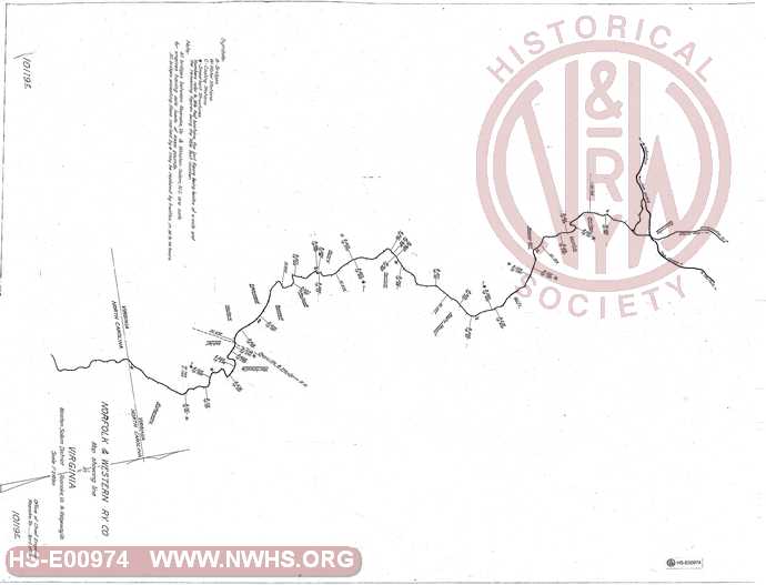
| Locator | Hist Soc - HS-E00974 | Type | Drawing | Doc Number | 10119E | |
|---|---|---|---|---|---|---|
| Description | Map showing N&W Winston-Salem District - Roanoke to N.C. State Line near Ridgeway | |||||
| Notes | Scale 1"=2000'. Shows Bridges, Tunnels, Water Stations, and Coaling Structures by Mile Post location. |
|||||
| Date | 04/17/1917 | Revision Date | ||||
| Author | N&W Rwy - Office Chief Engr | Accession | 2005.004 : Library of Virginia | |||

|
||
Size: 36in x 28in (91cm x 70cm) |
| Structures Indexes | |
|---|---|
| Category | Type |
| Bridge | |
| Water Tank | |
| Coal | Station |
| Company Document Indexes | ||
|---|---|---|
| Name | Section | SubSection |
| N&W Rwy | Maps | |
| Railroads and Companies | |
|---|---|
| Abbreviation | Name |
| N&W Rwy | Norfolk & Western Railway |
| Division Indexes | |||
|---|---|---|---|
| Road Name | Division | District/Branch | Mile Post |
| N&W Rwy | Shenandoah | Winston-Salem | |
| Related Documents | |||
|---|---|---|---|
| Type | Number | Locator | Description |
| Related | 10119H | Hist Soc - HS-G00822 | Map showing Durham District - Lynchburg to Durham |
| Related | 10119I | Hist Soc - HS-W00150 | Map Showing Line in Ohio. Kenova to Columbus, Portsmouth to Cincinnati. |
| Related | 10119A | Hist Soc - HS-D02825 | Map showing line of N&W in Maryland |
| Related | 10119F | Hist Soc - HS-D02826 | Map showing line of N&W in North Carolina on the Winston-Salem District |
| Related | 10119C | Hist Soc - HS-G00821 | Map showing N&W Clinch Valley District - Graham to Norton, VA |
| Related | 10119B | Hist Soc - HS-U00334 | Map Showing Line in Vrginia. |