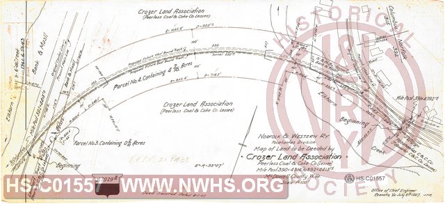
| Locator | Hist Soc - HS-C01557 | Type | Drawing | Doc Number | Y-7029B | |
|---|---|---|---|---|---|---|
| Description | Map of Land to be Deeded by Crozer Land Association, Mile Post 390+4316' to 392+4413', McDowell County WV. | |||||
| Notes | Parcels Number 3 & 4, for constructing Vivian Tunnel. Land required for realignment during double tracking. |
|||||
| Date | 07/06/1907 | Revision Date | 08/01/1907 | |||
| Author | N&W Rwy - Office Chief Engr | Accession | 2005.004 : Library of Virginia | |||

|
||
Size: 18in x 8in (45cm x 21cm) |
| Cities Indexes | |
|---|---|
| City | State |
| Kimball | WV |
| Vivian | WV |
| Structures Indexes | |
|---|---|
| Category | Type |
| Land | |
| Right of Way | |
| Track | Double Tracking |
| Railroads and Companies | |
|---|---|
| Abbreviation | Name |
| N&W Rwy | Norfolk & Western Railway |
| Crozer Land Association | |
| Division Indexes | |||
|---|---|---|---|
| Road Name | Division | District/Branch | Mile Post |
| N&W Rwy | Pocahontas | 391 | |
| Related Documents | |||
|---|---|---|---|
| Type | Number | Locator | Description |
| Parent | Y-7029 | Hist Soc - HS-B04168 | Map of Land to be Deeded by Crozer Land Association, Mile Post 392+4630' to 393+1356', McDowell County WV |