| Locator | Hist Soc - HS-E10614 | Type | Drawing | Doc Number | D-688 | |
|---|---|---|---|---|---|---|
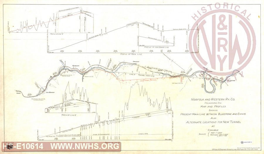
| Description | N&W Ry Co., Pocahontas Div., Map and Profiles showing Present Main Line between Bluestone and Ennis also Alternate locations for New Tunnels at Coaldale | |||||
| Notes | Shows three proposed tunnels. A - 12550' long, B - 7100' and C - 7200'. Shows bridges 850, 851, 853, 854, 855, 859, 860, 861. | |||||
| Date | 07/29/1913 | Revision Date | 04/12/1940 | |||
| Author | N&W Rwy - Office Engr Br Lines | Accession | 2009.001 : NS Corp/Va Tech Collection | |||

|
||
Size: 39in x 23in (99cm x 58cm) |
| Cities Indexes | |
|---|---|
| City | State |
| Bluestone | WV |
| Lick Branch | WV |
| Maybeury | WV |
| Ruth | WV |
| Cooper | WV |
| Ennis | WV |
| Coaldale | WV |
| Structures Indexes | |
|---|---|
| Category | Type |
| Tunnel | |
| Railroads and Companies | |
|---|---|
| Abbreviation | Name |
| N&W Rwy | Norfolk & Western Railway |
| Pocahontas Consolidated Coal Company | |
| Mill Creek Coal & Coke Company | |
| Elkhorn Coal & Coke Company | |
| Division Indexes | |||
|---|---|---|---|
| Road Name | Division | District/Branch | Mile Post |
| N&W Rwy | Pocahontas | 374 | |