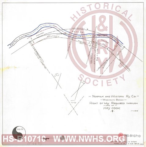
| Locator | Hist Soc - HS-B10710 | Type | Drawing | Doc Number | W15 / 6690 | |
|---|---|---|---|---|---|---|
| Description | N&W Rwy Widemouth Branch, Right of Way Required through land of May Cook. | |||||
| Notes | Scale 1"=100'. along right fork of Widemouth Creek. Two different document numbers. |
|||||
| Date | 07/23/1903 | Revision Date | ||||
| Author | N&W Rwy - Office Engr in Charg | Accession | 2009.001 : NS Corp/Va Tech Collection | |||

|
||
Size: 10in x 11in (27cm x 27cm) |
| Structures Indexes | |
|---|---|
| Category | Type |
| Land | |
| Right of Way | |
| Railroads and Companies | |
|---|---|
| Abbreviation | Name |
| N&W Rwy | Norfolk & Western Railway |
| Division Indexes | |||
|---|---|---|---|
| Road Name | Division | District/Branch | Mile Post |
| N&W Rwy | Pocahontas | Widemouth Br | |
| Related Documents | |||
|---|---|---|---|
| Type | Number | Locator | Description |
| Related | 6690 | Hist Soc - HS-B10711 | Map Showing Right of Way for Widemouth Extension N&W Rwy, through land of May Cook. |