| Locator | Hist Soc - HS-C01444 | Type | Drawing | |||
|---|---|---|---|---|---|---|
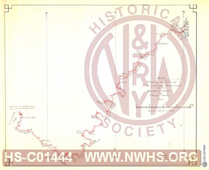
| Description | Map showing the line of The proposed Railroad up the Bluestone River and Camp Creek | |||||
| Notes | Scale 1"=1 mile. Line from "New River Railroad" along New River at Glen Lyn to Camp Creek. 26 miles | |||||
| Date | 08/01/1881 | Revision Date | ||||
| Author | Hotchkiss, Jedediah | Accession | ||||

|
||
Size: 15in x 12in (39cm x 32cm) |
| Cities Indexes | |
|---|---|
| City | State |
| Glen Lyn | VA |
| Railroads and Companies | |
|---|---|
| Abbreviation | Name |
| N&W RR | Norfolk & Western Railroad |
| New River Railroad | |
| Division Indexes | |||
|---|---|---|---|
| Road Name | Division | District/Branch | Mile Post |
| N&W RR | New River | ||
| Related Documents | |||
|---|---|---|---|
| Type | Number | Locator | Description |
| Related | Hist Soc - HS-CC00690 | Map showing the line of The proposed Railroad up East River | |