| Locator | Hist Soc - HS-B10646 | Type | Drawing | Doc Number | A1466 | |
|---|---|---|---|---|---|---|
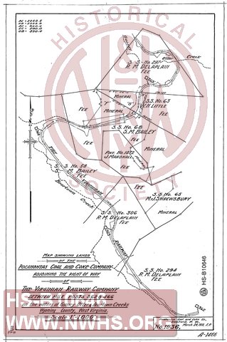
| Description | Map Showing Lands of the Pocahontas Coal and Coke Company adjoining the Right of Way of The Virginian Railway Co. betwene Mile Posts 362 & 366 on the water of Gooney Otter & Beartown Creeks, Wyoming County WV | |||||
| Notes | Scale 1"=1000'. Traced from Pocahontas Coal and Coke Company drawing No. 1936. | |||||
| Date | 03/24/1919 | Revision Date | 07/31/1919 | |||
| Author | VGN Railway | Accession | 2009.001 : NS Corp/Va Tech Collection | |||

|
||
Size: 9in x 13in (23cm x 34cm) |
| Cities Indexes | |
|---|---|
| City | State |
| Herndon | WV |
| Micajah | WV |
| Railroads and Companies | |
|---|---|
| Abbreviation | Name |
| VGN Rwy | Virginian Railway |
| Pocahontas Coal & Coke Company | |
| Division Indexes | |||
|---|---|---|---|
| Road Name | Division | District/Branch | Mile Post |
| VGN Rwy | New River | 364 | |