| Locator |
Hist Soc - HS-G10239 |
Type |
Drawing |
| Description |
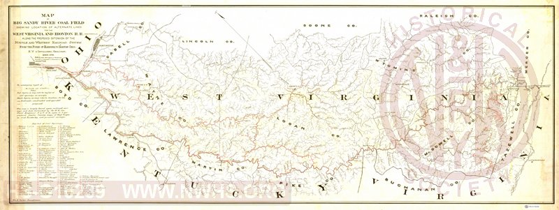
Map of Big Sandy River Coal Field showing location of Alternate Lines for the West Virginia and Ironton RR along the proposed extension of the Norfolk and Western Railroad System from the Forks of Elkhorn to Ironton, OH, May 1889 |
| Notes |
E.V. D'Invilliers, Geologist. Drawn by Wm. E. Parker, Draughtsman.
Scale 1 inch = 2 miles.
Includes a numbered list of 135 coal openings. |
| Date |
05/01/1889 |
Revision Date |
|
| Author |
|
Accession |
2009.001 : NS Corp/Va Tech Collection |
