| Locator | Hist Soc - HS-C01034 | Type | Map | Doc Number | 7796-A | |
|---|---|---|---|---|---|---|
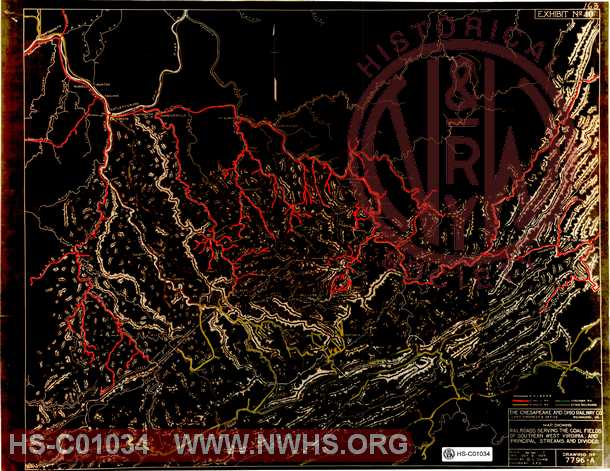
| Description | C&O Map Showing railroads servig the coal fields of southern West Virginia and principal streams and divides. | |||||
| Notes | Has color info for C&O, N&W, VGN and K.G.J.&E. RR. Portsmouth OH to Roanoke area. | |||||
| Date | 10/08/1927 | Revision Date | ||||
| Author | C&O Rwy Co | Accession | 2005.004 : Library of Virginia | |||

|
||
Size: 21in x 16in (54cm x 42cm) |
| Railroads and Companies | |
|---|---|
| Abbreviation | Name |
| C&O | Chesapeake & Ohio |
| N&W Rwy | Norfolk & Western Railway |
| VGN Rwy | Virginian Railway |
| KGJ&E | Kanawha, Glen Jean & Eastern Railway |