| Locator | Hist Soc - HS-H10087 | Type | Drawing | |||
|---|---|---|---|---|---|---|
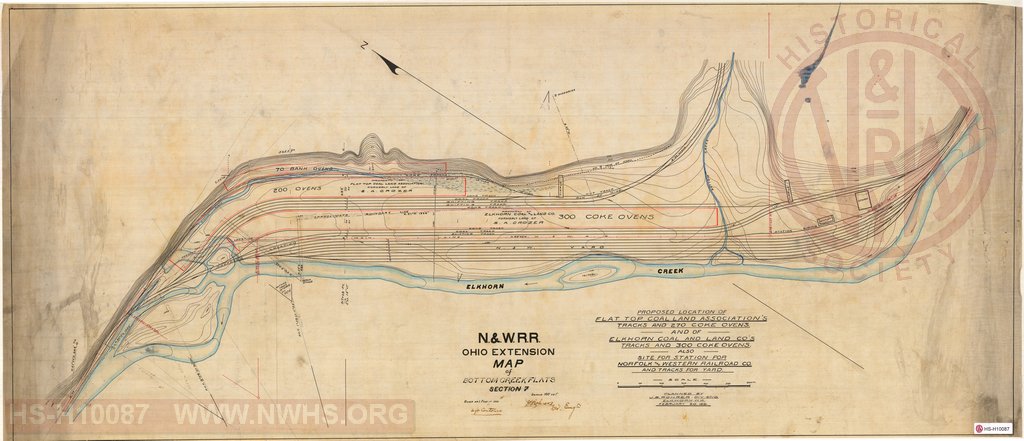
| Description | Map of Bottom Creek Flats, Section 7, Ohio Extension, N&W R.R. | |||||
| Notes | Proposed Location of Flat Top Coal Land Association's Tracks and 270 Coke Ovens and of Elkhorn Coal and Land Co's Tracks and 300 Coke Ovens also Site for Station for Norfolk and Western Railroad Co. and Tracks for Yard Scale 100'=1" |
|||||
| Date | 02/20/1891 | Revision Date | ||||
| Author | N&W RR - Office Div Engr | Accession | 2009.001 : NS Corp/Va Tech Collection | |||

|
||
Size: 46in x 20in (118cm x 51cm) |
| Cities Indexes | |
|---|---|
| City | State |
| Kimball | WV |
| Vivian | WV |
| Bottom Creek | WV |
| Structures Indexes | |
|---|---|
| Category | Type |
| Yard | |
| Track | Yard |
| Coal | Tipple |
| Station | Lot |
| Coke | Ovens |
| Railroads and Companies | |
|---|---|
| Abbreviation | Name |
| N&W RR | Norfolk & Western Railroad |
| Flat Top Coal Land Co | |
| Elkhorn Coal and Land Company | |
| Division Indexes | |||
|---|---|---|---|
| Road Name | Division | District/Branch | Mile Post |
| N&W RR | Ohio Extension | ||