Locator Hist Soc - HS-D10739 Type Drawing Doc Number A-300
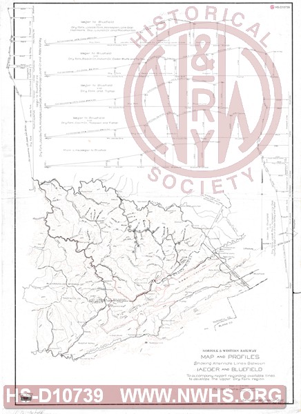
Description Map and profiles showing Alternate Lines between Iaeger and Bluefield, to accompany report recording available lines to develop the Upper Dry Fork region.
Notes Shows four alternate routes and comparison with Pocahontas main line. One of four was chosen route via Cedar Bluff, others via Jacabs Fork to Tazewell, Tip Top or Pocahontas.
Date 09/30/1902 Revision Date 04/23/1903
Author N&W Rwy - Kenova, WV Accession 2008.001 : Roanoke Chapter - NRHS

Map and profiles showing Alternate Lines between Iaeger and Bluefield, to accompany report recording available lines to develop the Upper Dry Fork region.

Size: 24in x 33in (60cm x 83cm)


Cities Indexes
City State
Bluefield WV
Pocahontas VA
Iaeger WV
Cedar Bluff VA
Tazewell VA
Bluefield VA
Jacobs Fork WV
Tip Top VA

Company Document Indexes
Name Section SubSection
N&W Rwy Maps  

Division Indexes
Road Name Division District/Branch Mile Post
N&W Rwy Pocahontas    
N&W Rwy Pocahontas Pocahontas Br  
N&W Rwy Pocahontas Clinch Valley District  
N&W Rwy Pocahontas Dry Fork Br  
N&W Rwy Pocahontas Jacobs Fork Branch