| Locator | Hist Soc - HS-CC10333 | Type | Drawing | Doc Number | 7607 | |
|---|---|---|---|---|---|---|
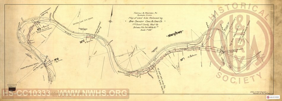
| Description | Map of Land to be Released by Big Sandy Coal & Coke Co., between Mileposts 408 & 411 near Marytown, WV | |||||
| Notes | Shows map of tracks between mileposts 408 and 411, including spurs for Big Sandy Coal & Coke, Flournoy Coal Co, Hensley Coal Co, and Twin Branch Mines, plus "Swan Siding". Shows both original single-track alignment and proposed alignment of double track, including bridges 902 and 903 and original single-track Twin Branch tunnel, plus new Twin Branch No. 2 tunnel on proposed alignment. | |||||
| Date | 05/22/1907 | Revision Date | ||||
| Author | N&W RR - Office of Chief Engr | Accession | 2009.001 : NS Corp/Va Tech Collection | |||

|
||
Size: 37in x 13in (93cm x 33cm) |
| Cities Indexes | |
|---|---|
| City | State |
| Twin Branch | WV |
| Marytown | WV |
| Structures Indexes | |
|---|---|
| Category | Type |
| Track | Double Tracking |
| Railroads and Companies | |
|---|---|
| Abbreviation | Name |
| N&W Rwy | Norfolk & Western Railway |
| Big Sandy Coal & Coke Co. | |
| Flournoy Coal Co. | |
| Hensley Coal Co. | |
| Twin Branch Mines | |
| Division Indexes | |||
|---|---|---|---|
| Road Name | Division | District/Branch | Mile Post |
| N&W Rwy | Pocahontas | 409 | |